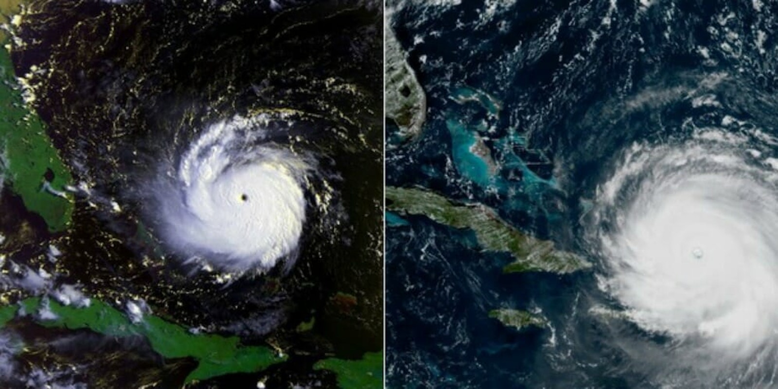
Less than two weeks after Hurricane Harvey destroyed large swaths of Texas, Hurricane Irma is set to make landfall on Florida this weekend, and it looks like it could be an even more devastating storm.
Irma has blasted through parts of the Caribbean—the American Red Cross estimates that 1.2 million people already have been affected by the storm, according to CNN—and the U.S. National Hurricane Center expects it to be a Category 4 hurricane when it eventually lands in south Florida.
If you wanted a visual representation to see just how big this storm is, check out this GIF.
I combined the images of Hurricane Andrew (1992) & Hurricane Irma (today) at scale in a gif. Irma is a damn leviathan. pic.twitter.com/4HEw1NNxxd
— this place is hell (@OkayWordsByJoel) September 7, 2017
Joel Nihlean—a writer and editor from Spicewood, Texas—made the GIF after combining the two satellite images of the storm tweeted out by meteorologist Eric Holthaus.
On the left, Hurricane Andrew (1992).
— Eric Holthaus (@EricHolthaus) September 7, 2017
On the right, Hurricane Irma (today).
(images to scale) pic.twitter.com/JCdxuP0tqm
Hurricane Andrew hit Florida 25 years ago, leaving 65 people dead and causing $26.5 billion in damage (about $50 billion in today’s dollars).
Might be time to revisit this @MiamiHerald headline from Hurricane Andrew, 1992 pic.twitter.com/J7VaCEhEz4
— Bill Grueskin (@BGrueskin) September 8, 2017
Wrote CBS News:
Both Andrew and Irma started as wisps of unstable weather off Africa and chugged across the Atlantic as ever-intensifying Cape Verde storms. And while they may both end up in the same general area, meteorologists said that’s where the similarities disappear.
Andrew a quarter century ago was an unusually compact major storm that roared east-to-west almost in a straight line and hit just south of the core of Miami. Months after its August 23, 1992, landfall, meteorologists upgraded it to a Category 5 hurricane with 167 mph winds at one point and 17-foot storm surge in another.
While Andrew basically went in a straight line east to west, Irma is forecast to hit Florida from the southern tip and move north through the peninsula.
“The effect of Irma on the state of Florida is going to be much greater than Andrew’s effect,” Weather Channel senior hurricane specialist Bryan Norcross told CBS News. “We’re dealing with an entirely different level of phenomenon. There is no storm to compare with this. Unless you go way back to 1926.”
According to the National Weather Service, parts of south Florida could be “uninhabitable for weeks or months.”
H/T Grist.org


