A considerable amount of chatter has been made in regards to the dumb things people tweet, but considerably less attention has been paid to precisely where people were when they tweeted those dumb things.
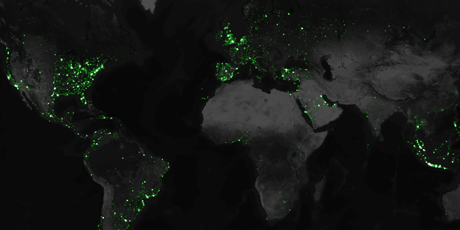
Data artist Eric Fischer has attempted to rectify that with a project mapping the location of the 6.3 billion geotagged tweets sent out over the microblogging service over three-and-a-half years. After Fischer collected the nearly three terabytes of data from Twitter’s public API, he cleaned up the information a bit to account for things like duplicate tweets and then displayed it on a map showing the global distribution of messages sent over the platform.
Fischer’s map shows heavy concentrations of tweets in North American population centers like New York and Los Angeles, as well as in Western European nations like the U.K. and Spain.
While Turkish Prime Minister Tayyip Erdo?an recently said that he is “increasingly against the Internet” and cracked down on Twitter users who have been openly critical of his ruling regime, his hometown of Istanbul is one of the points on the map that shines the brightest. Other major global activity hubs include Singapore and Bangkok, Thailand.
Interestingly, while Twitter is officially prohibited in mainland China, a few faint spots of light do appear there—largley centered around the capital of Beijing.
Fischer isn’t the only one to have made a visualization of Twitter’s international network. The One Million Tweet Map does something very similar, but limits itself to only showing the locations of the million most recent messages.
Screencap via Eric Fischer/Mapbox


